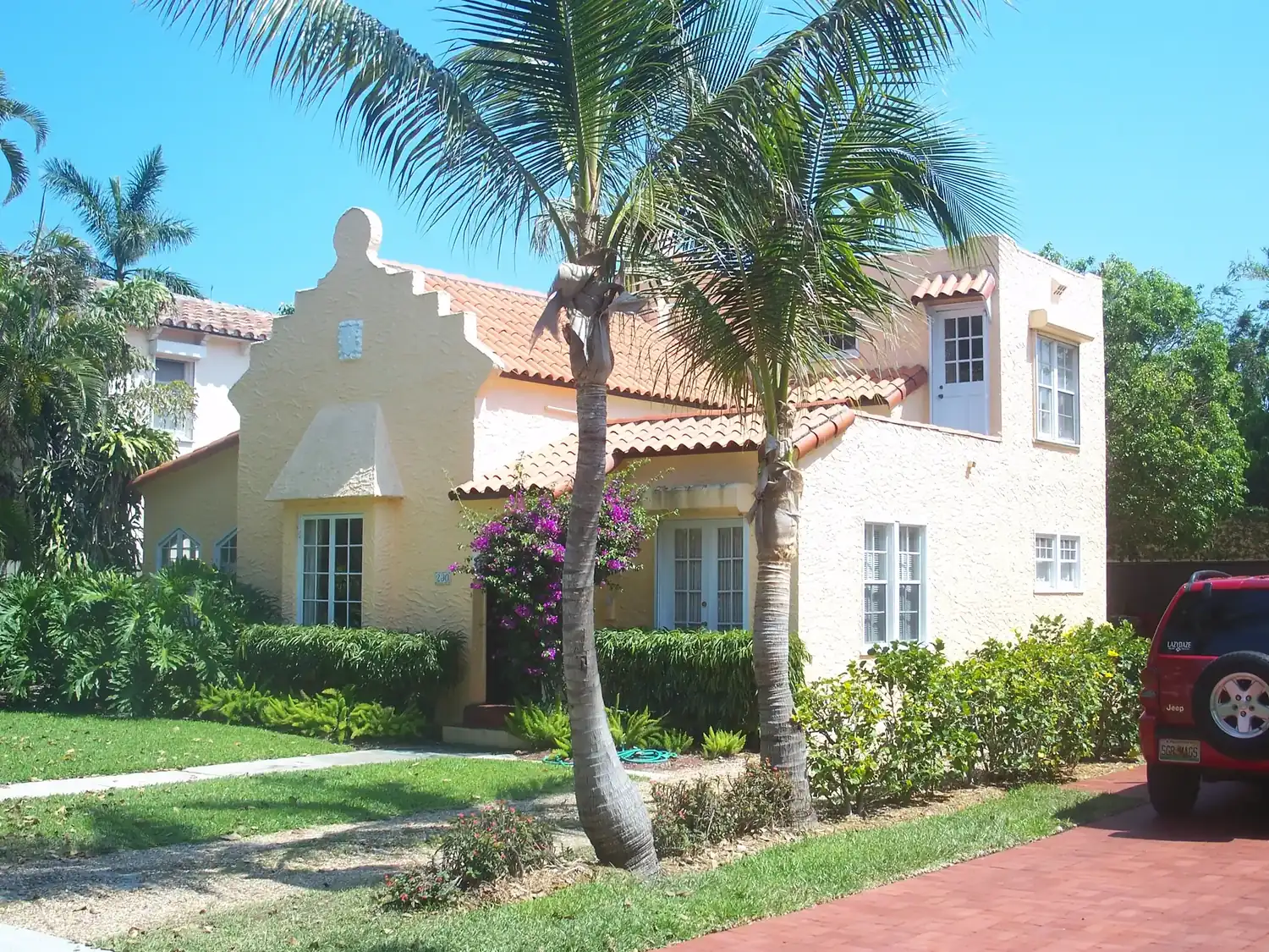
Eleven West Palm Beach neighborhoods from the city's own maps, with ZIP codes, zoned high schools, Zillow home values and a page for each.
Last checked Oct. 10, 2026. Sources: the City of West Palm Beach’s neighborhood association map, historic districts map, Downtown Master Plan boundary, parcel and address layers, Palm Beach County’s school zone open data, the Florida Department of Education’s 2026 school grades, the Zillow Home Value Index (Zillow Research), the U.S. Census Bureau and © OpenStreetMap contributors.
West Palm Beach has two very different halves. The older east side runs north and south along the Lake Worth Lagoon, with downtown in the middle, the Northwood neighborhoods to the north and the historic districts and the South End to the south. I-95 runs north and south about a mile inland, and Okeechobee Boulevard and Southern Boulevard carry traffic west. Beyond I-95 the city reaches miles west, around the city’s Grassy Waters Preserve, to Ibis off Northlake Boulevard. The city limits cover about 58 square miles, according to the city’s boundary layer, and about 122,290 people lived there in the Census Bureau’s 2020-2024 American Community Survey.
Addresses fall mainly in seven ZIP codes, from the city’s address layer: 33401 (downtown and the historic districts just south), 33405 (the south end of the city), 33407 (Northwood and the north end), and 33409, 33411, 33412 and 33417 west of I-95. ZIP codes and the “West Palm Beach” mailing address also reach outside the city, and school zones do not follow city limits at all: four of the areas below send their elementary students across the lagoon to Palm Beach Public School, and Ibis is zoned for schools in Loxahatchee and Westlake.
What this means for you
- Check the city limits, the ZIP code and the school zone separately for any address; they do not line up.
- Zillow’s typical home value in August 2026 ranged from $356,104 in ZIP code 33407 to $835,049 in 33412; the city figure was $404,294.
- Ten of the 11 areas below are zoned for Forest Hill Community High or Palm Beach Lakes Community High.
The neighborhoods at a glance
| # | Area | ZIP code | Zoned high school (2026 grade) | Typical home value in the ZIP, August 2026 |
|---|---|---|---|---|
| 1 | Downtown | 33401 | Forest Hill (A) for 83%; Palm Beach Lakes (C) | $447,355 |
| 2 | Northwest | 33401 | Forest Hill (A) | $447,355 |
| 3 | Pleasant City | 33407 | Palm Beach Lakes (C) | $356,104 |
| 4 | Old Northwood | 33407 | Palm Beach Lakes (C) | $356,104 |
| 5 | Northwood Hills | 33407 | Palm Beach Lakes (C) | $356,104 |
| 6 | Grandview Heights | 33401 | Forest Hill (A) | $447,355 |
| 7 | Flamingo Park | 33401 | Forest Hill (A) | $447,355 |
| 8 | El Cid | 33401 and 33405 | Forest Hill (A) | $447,355 (33401); $636,629 (33405) |
| 9 | South End | 33405 | Forest Hill (A) | $636,629 |
| 10 | Dreher Park | 33405 | Forest Hill (A) | $636,629 |
| 11 | Ibis | 33412 | Seminole Ridge (B) | $835,049 |
High schools are matched to every home parcel from Palm Beach County’s open data copy of the district’s zones; grades are Florida’s 2026 school grades. Home values are the Zillow Home Value Index, a modeled typical value for the middle third of homes, not a sale price, and each covers a whole ZIP code, not one neighborhood. More in our home prices guide and schools guide.
Map
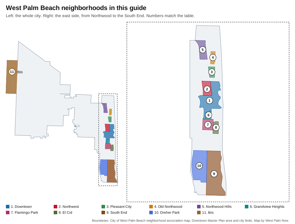
Map by West Palm Now from the City of West Palm Beach’s neighborhood association map, Downtown Master Plan boundary and city limits layer.
Downtown
The area inside the city’s Downtown Master Plan boundary, about 3,900 homes, nearly all condominium units, from Clematis Street to the Tri-Rail station. Most homes are zoned for Forest Hill Community High. Downtown page.
Northwest
The historic neighborhood along Tamarind Avenue north of the Tri-Rail station, listed on the National Register in 1992, with about 360 home parcels and Alice Mickens Park. Northwest page.
Pleasant City
About 215 home parcels between the rail yard and North Dixie Highway, from about 16th to 23rd streets, with Pleasant City Elementary and Blum Park inside it. Pleasant City page.
Old Northwood
About 314 single-family houses, half built by 1935, east of Broadway from 26th to 35th streets; on the National Register since 1994. Old Northwood page.
Northwood Hills
The largest of the Northwood neighborhoods on the city’s map, about 750 single-family houses up to 45th Street, with Northmore Elementary inside it. Northwood Hills page.
Grandview Heights
A 62-acre historic neighborhood of houses, townhouses and small apartment buildings just south of Okeechobee Boulevard, next to Howard Park. Grandview Heights page.
Flamingo Park
About 560 home parcels between Parker Avenue and Dixie Highway north of Belvedere Road, half of its houses built by 1928; on the National Register since 2000. Flamingo Park page.
El Cid
The waterfront historic district between Dixie Highway and Flagler Drive, on streets with Spanish names, split between ZIP codes 33401 and 33405. El Cid page.
South End
About 2,100 single-family houses on 1,000 acres south of Southern Boulevard, with South Olive Park and Phipps Park. South End page.
Dreher Park
About 1,500 single-family houses around the 121-acre Dreher Park and the Palm Beach Zoo, between I-95 and the South End. Dreher Park page.
Ibis
About 1,860 homes on nearly 2,000 acres in the far west, next to Grassy Waters Preserve, built since 1991 and about 15 miles by road from downtown. Ibis page.
How we built this
We started from the city’s own maps. The Mayor’s Office neighborhood association map lists 59 associations, with boundaries the city says residents drew and association presidents approved; the city notes that the associations are voluntary and self-administered. The Planning Department’s historic districts map lists 19 local districts, and its Downtown Master Plan layer draws the downtown boundary. We then checked OpenStreetMap’s place names inside the city, which add few names beyond these, and the Census ZIP codes.
We chose the 11 areas the city’s maps name and bound clearly and that hold the most homes on the east side, plus Ibis, the largest association area west of I-95. Many smaller areas on the city’s map are single homeowners associations, among them Andros Isle, Baywinds, Briar Bay, Riverwalk, Sandalwood Lakes and the Bear Lakes communities west of I-95, and the Northwood Shores, Northwood Harbor, Northboro Park, Prospect Park, Southland Park and Vedado areas east of it. Home counts come from the city’s parcel layer and ZIP codes from its address layer on Oct. 10, 2026.
Related: moving to West Palm Beach, property taxes, getting around and West Palm Beach vs. Riviera Beach vs. Lake Park vs. Palm Beach.
Frequently asked questions
What are the neighborhoods in West Palm Beach?
The city’s neighborhood map lists 59 neighborhood and homeowners associations. This guide covers 11 areas: Downtown, Northwest, Pleasant City, Old Northwood, Northwood Hills, Grandview Heights, Flamingo Park, El Cid, the South End, Dreher Park and Ibis.
What ZIP codes are in West Palm Beach?
The city’s address layer puts West Palm Beach addresses mainly in 33401, 33405, 33407, 33409, 33411, 33412 and 33417. A West Palm Beach mailing address does not always mean the city itself.
Do West Palm Beach school zones follow city limits?
No. Downtown, Grandview Heights, Flamingo Park and El Cid homes are zoned for Palm Beach Public School on the island of Palm Beach, and Ibis is zoned for schools in Loxahatchee and Westlake.
Which West Palm Beach neighborhoods are historic districts?
The city’s historic districts map lists 19 districts, among them Old Northwood, Northwood Hills, Northwest, Grandview Heights, Flamingo Park, El Cid, Prospect Park-Southland Park, Vedado-Hillcrest and Belair.
Have your say