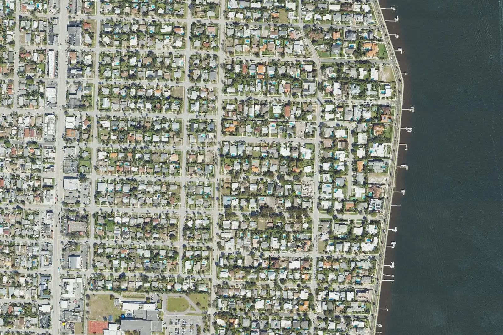
The South End has about 2,100 single-family houses south of Southern Boulevard in ZIP code 33405, zoned for South Olive Elementary and Forest Hill High.
Last checked Oct. 10, 2026. Sources: the City of West Palm Beach’s neighborhood association map, historic districts map, parks map and parcel layer, Palm Beach County’s school zone open data, the Florida Department of Education’s 2026 school grades, the Zillow Home Value Index (Zillow Research), Palm Tran and © OpenStreetMap contributors.
The South End covers about 1,000 acres south of Southern Boulevard, running past Forest Hill Boulevard, from just west of Georgia Avenue east across Dixie Highway to Flagler Drive on the Lake Worth Lagoon. On the city’s neighborhood map it is the area of the South End Neighborhood Association, with about 2,400 home parcels, nearly all single-family houses, and every address but one in ZIP code 33405. The city’s small Belair local historic district is inside it.
What this means for you
- High school: Forest Hill Community High, for every home parcel. It earned an A in Florida’s 2026 grades.
- Home value: $636,629 in ZIP code 33405 in August 2026, according to the Zillow Home Value Index.
- Nearest I-95 exit: exit 66 (Forest Hill Boulevard), about 1.4 miles by road; exit 68 (Southern Boulevard) is about 2.2 miles.
Part of our West Palm Beach neighborhoods guide.
Where it is
The South End stretches about two miles from Southern Boulevard south along the lagoon. Its streets include Plymouth, Gregory, Pilgrim, Washington, Churchill and Puritan roads, Nottingham Boulevard and Lakewood Road. The Dreher Park neighborhood, with its own page, is to the west.
From the city’s parcel layer:
| Home type | Count |
|---|---|
| Single-family houses | 2,112 |
| Small apartment buildings (under 5 units) | 266 |
| Apartment buildings of 5 units or more | 10 |
| Townhouses | 6 |
Half of the single-family houses were built in 1952 or earlier, according to the parcel records, which date the oldest to 1896. About 63% of the home parcels (1,512) carry a homestead exemption, the Property Appraiser’s mark of a full-time owner’s residence.
Schools
From Palm Beach County’s open data copy of the School District of Palm Beach County’s attendance zones, matched to every home parcel:
| Level | Zoned school | Share of home parcels | Florida 2026 grade |
|---|---|---|---|
| Elementary | South Olive Elementary, 7101 S. Olive Ave. | 99% | A |
| Elementary | Palmetto Elementary, 5801 Parker Ave. | 1% | A |
| Middle | Conniston Middle, 3630 Parker Ave. | 100% | B |
| High | Forest Hill Community High, 6901 Parker Ave. | 100% | A |
Each school name links to its state report card. South Olive Elementary is inside the neighborhood. Zones can change, so check the exact address on the district’s Find My School map. More in our schools guide.
Home values
The typical home value in ZIP code 33405 was $636,629 in August 2026, up 8.5% from $586,621 in August 2025. Zillow’s figure for West Palm Beach as a whole was $404,294, up 1.4%. The Zillow Home Value Index is a modeled typical value for the middle third of homes, single-family houses and condos together, not a sale price. ZIP code 33405 also covers Dreher Park and part of El Cid. More in our home prices guide.
Parks and trails
From the city’s parks map and parks listing:
- South Olive Park and Community Center, 345 Summa St.: gym, playground, sports fields and a paved walking trail.
- Phipps Park, about 25 acres, at the neighborhood’s north end near Southern Boulevard.
- Summa Beach Park and the city’s waterfront open space along Flagler Drive.
- Mary Brandon Park, on its western edge, and Dreher Park, about 0.4 mile west.
More in our parks and trails guide.
Getting around
- I-95: exit 66 (Forest Hill Boulevard), about 1.4 miles by road; exit 68 (Southern Boulevard), about 2.2 miles.
- City Hall, 401 Clematis St.: about 4.1 miles.
- Airport (1000 James L. Turnage Blvd.): about 4.8 miles.
- These are distances measured on the OpenStreetMap road network with the OSRM routing engine from the middle of the neighborhood to where each exit meets its cross street, not drive times. Exit numbers are from OpenStreetMap.
- Bus: Palm Tran’s September 2026 schedule data shows Route 1 (U.S. 1) stopping along Dixie Highway and Route 46 (Forest Hill Boulevard) on Forest Hill Boulevard and Dixie Highway. See Palm Tran’s route pages.
More in our getting around guide.
HOAs
The city’s neighborhood map lists the South End Neighborhood Association here. The city’s notes on that map say neighborhood associations are self-administered and not mandated by the city.
Groceries and everyday stores
OpenStreetMap lists a Winn-Dixie at 7915 S. Dixie Hwy. and a Walgreens at 4001 S. Dixie Hwy., both inside the neighborhood, and a Publix at 828 Southern Blvd. and a CVS Pharmacy at 818 Southern Blvd., about 0.2 mile from its northern edge.
How we drew this area
This page follows the South End Neighborhood Association boundary on the City of West Palm Beach’s neighborhood association map. Home counts come from the city’s parcel layer on Oct. 10, 2026, and ZIP codes from the city’s address layer. Each home parcel was matched to Palm Beach County’s open data copy of the district’s attendance zones. Store locations and road distances use © OpenStreetMap contributors.
Frequently asked questions
What schools is the South End of West Palm Beach zoned for?
Nearly every home parcel is zoned for South Olive Elementary, and all are zoned for Conniston Middle and Forest Hill Community High, in Palm Beach County’s copy of the district’s zones. South Olive and Forest Hill earned an A in Florida’s 2026 grades.
What ZIP code is the South End in?
33405, for all but one address in the city’s address layer.
Is the South End of West Palm Beach a good place to live?
Here are the facts. The South End has about 2,400 home parcels, 2,112 of them single-family houses, with South Olive Park, Phipps Park and the lagoon along Flagler Drive. The typical home value in ZIP code 33405 was $636,629 in August 2026, according to Zillow.
What is at South Olive Park?
A community center with a gym, a playground, sports fields and a paved walking trail, at 345 Summa St., according to the city’s parks listing.
Have your say