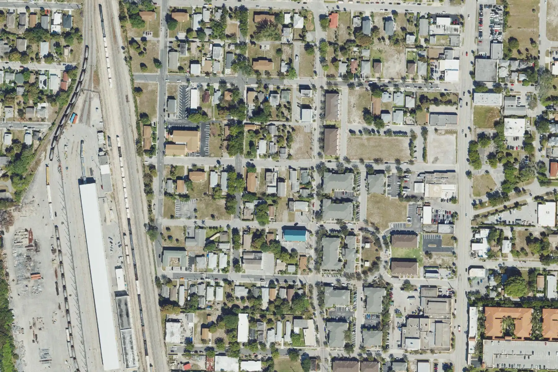
Pleasant City has about 215 home parcels off North Dixie Highway in ZIP code 33407, zoned for Pleasant City Elementary and Palm Beach Lakes High.
Last checked Oct. 10, 2026. Sources: the City of West Palm Beach’s neighborhood association map, parks map and parcel layer, Palm Beach County’s school zone open data, the Florida Department of Education’s 2026 school grades, the Zillow Home Value Index (Zillow Research), Palm Tran and © OpenStreetMap contributors.
Pleasant City is a small neighborhood on the north side of downtown, on the numbered streets from about 16th Street to 23rd Street between the railroad and North Dixie Highway. On the city’s neighborhood map it is the area of the Pleasant City Neighborhood Association: about 91 acres and about 215 home parcels, nearly all in ZIP code 33407. Its side streets include Merry Place, Happy Street, Beautiful Avenue and Cheerful Street.
What this means for you
- High school: Palm Beach Lakes Community High, for every home parcel. It earned a C in Florida’s 2026 grades.
- Home value: $356,104 in ZIP code 33407 in August 2026, according to the Zillow Home Value Index.
- Nearest I-95 exit: exit 71 (Palm Beach Lakes Boulevard), about 3 miles by road; exits 70 (Okeechobee Boulevard) and 74 (45th Street) are each about 3.8 miles.
Part of our West Palm Beach neighborhoods guide.
Where it is
Pleasant City lies between the rail yard on its west side and North Dixie Highway on its east, with Spruce Avenue running north and south through it. Old Northwood is to the north and the Coleman Park neighborhood to the west on the city’s map.
From the city’s parcel layer:
| Home type | Count |
|---|---|
| Single-family houses | 111 |
| Small apartment buildings (under 5 units) | 36 |
| Townhouses | 34 |
| Apartment buildings of 10 units or more | 18 |
| Apartment buildings of 5 to 9 units | 14 |
Half of the single-family houses were built in 1994 or later, according to the parcel records, which date the oldest to 1920. About 37% of the home parcels (79) carry a homestead exemption, the Property Appraiser’s mark of a full-time owner’s residence.
Schools
From Palm Beach County’s open data copy of the School District of Palm Beach County’s attendance zones, matched to every home parcel:
| Level | Zoned school | Share of home parcels | Florida 2026 grade |
|---|---|---|---|
| Elementary | Pleasant City Elementary, 2222 Spruce Ave. | 100% | B |
| Middle | Roosevelt Middle, 1900 N. Australian Ave. | 100% | B |
| High | Palm Beach Lakes Community High, 3505 Shiloh Drive | 100% | C |
Each school name links to its state report card. Pleasant City Elementary is inside the neighborhood, on Spruce Avenue. Zones can change, so check the exact address on the district’s Find My School map. More in our schools guide.
Home values
The typical home value in ZIP code 33407 was $356,104 in August 2026, up 2.7% from $346,612 in August 2025. Zillow’s figure for West Palm Beach as a whole was $404,294, up 1.4%. The Zillow Home Value Index is a modeled typical value for the middle third of homes, single-family houses and condos together, not a sale price. It covers all of ZIP code 33407, which takes in the Northwood neighborhoods too, not Pleasant City alone. More in our home prices guide.
Parks and trails
From the city’s parks map and parks listing:
- Blum Park, 2301 Spruce Ave.: playground, pavilion, restrooms and a multipurpose field.
- Pleasant City Park, inside the neighborhood.
- Nathaniel Adams Park and Joel T. Daves Park, on its edges.
- Currie Park, 2400 N. Flagler Drive on the waterfront, about 0.2 mile east. The city listed it as closed for construction apart from its tennis courts; check before you go.
More in our parks and trails guide.
Getting around
- I-95: exit 71 (Palm Beach Lakes Boulevard), about 3 miles by road; exit 70 (Okeechobee Boulevard) and exit 74 (45th Street), each about 3.8 miles.
- City Hall, 401 Clematis St.: about 1.4 miles.
- Airport (1000 James L. Turnage Blvd.): about 5.1 miles.
- These are distances measured on the OpenStreetMap road network with the OSRM routing engine from the middle of the neighborhood to where each exit meets its cross street, not drive times. Exit numbers are from OpenStreetMap.
- Bus: Palm Tran’s September 2026 schedule data shows Route 1 (U.S. 1) stopping on Dixie Highway from 13th Street to 21st Street and at 24th Street and Spruce Avenue. See Palm Tran’s route pages.
More in our getting around guide.
HOAs
The city’s neighborhood map lists the Pleasant City Neighborhood Association here. The city’s notes on that map say neighborhood associations are self-administered and not mandated by the city.
Groceries and everyday stores
OpenStreetMap lists a CVS Pharmacy at 1301 N. Dixie Hwy., about 0.15 mile south of the neighborhood’s edge. The nearest supermarkets it lists are about a mile away in a straight line: the Publix at 275 S. Rosemary Ave. downtown and the Publix at 135 Bradley Place in Palm Beach.
How we drew this area
This page follows the Pleasant City Neighborhood Association boundary on the City of West Palm Beach’s neighborhood association map. Home counts come from the city’s parcel layer on Oct. 10, 2026, and ZIP codes from the city’s address layer. Each home parcel was matched to Palm Beach County’s open data copy of the district’s attendance zones. Store locations and road distances use © OpenStreetMap contributors.
Frequently asked questions
What schools is Pleasant City in West Palm Beach zoned for?
Every home parcel is zoned for Pleasant City Elementary, Roosevelt Middle and Palm Beach Lakes Community High in Palm Beach County’s copy of the district’s zones. They earned a B, a B and a C in Florida’s 2026 grades.
What ZIP code is Pleasant City in?
33407, for all but a handful of addresses, in the city’s address layer.
Is Pleasant City a good place to live?
Here are the facts. Pleasant City has about 215 home parcels, half of them single-family houses, with Blum Park and Pleasant City Park inside it and Palm Tran Route 1 on Dixie Highway. The typical home value in ZIP code 33407 was $356,104 in August 2026, according to Zillow.
What is at Blum Park in West Palm Beach?
A playground, pavilion, restrooms and a multipurpose field, at 2301 Spruce Ave., according to the city’s parks listing.
Have your say