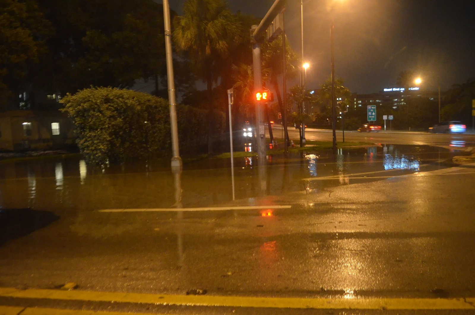
The NWS upgraded to a coastal flood warning from 2 a.m. Monday to 8 p.m. Tuesday, with major flooding possible at high tide. Tide times and what to avoid.
The National Weather Service has put coastal Palm Beach County under a coastal flood advisory, and it now expects moderate coastal flooding. That is a step beyond what the city of West Palm Beach told residents to expect earlier this month.
Updated Oct. 30: The king tides passed major flood stage. The weather service’s Lake Worth tide gauge peaked at 2.71 feet above the normal high-tide line at 9:24 a.m. Tuesday and 2.67 feet Wednesday; major flooding starts at 2.5 feet. The warning was extended to 8 p.m. Wednesday, and a coastal flood advisory now runs until 8 p.m. Saturday, Oct. 31. Details in our Oct. 30 story.
Updated Oct. 25: The weather service has upgraded to a coastal flood warning from 2 a.m. Monday to 8 p.m. Tuesday, and extended this advisory until the warning starts. It now expects flooding to reach major flood stage on Monday and Tuesday. Read our story on the warning.
The weather service office in Miami issued the coastal hazard message at 3:54 p.m. Thursday. The advisory originally ran until 8 p.m. Saturday.
The worst is expected after that. The weather service said the advisory “will either need to be extended into next week or upgraded to a warning Sunday into Monday.” That is when the king tides peak and when rain chances and onshore winds are highest, it said.
What the weather service expects
The advisory covers coastal Palm Beach County, which takes in West Palm Beach’s waterfront along the Lake Worth Lagoon. For the advisory period, the weather service expects:
- moderate coastal flooding
- flooding of lots, parks and roads, with only isolated road closures
- large breaking waves of 6 to 8 feet in the surf zone until 2 a.m. Saturday
- dangerous rip currents through Saturday evening, and localized beach erosion
The city said in its king tide release on Oct. 5 that this year’s king tides were not expected to reach moderate or major flood stage. The city’s own forecast said the tides of Oct. 26-29 would come within 3 inches of flood stage. The city also warned that heavy rain and strong wind could make flooding worse than the tide alone, and the weather service’s forecast now has both.
Rain and wind on top of the tide
The weather service forecast for West Palm Beach on Friday showed the weather building through the weekend:
| Period | Chance of rain | Northeast wind |
|---|---|---|
| Saturday | 50% | 10 to 15 mph, gusts to 24 mph |
| Saturday night | 70% | 8 to 14 mph, gusts to 26 mph |
| Sunday | 90% | 14 to 22 mph, gusts to 35 mph |
| Sunday night | 90% | 15 to 20 mph, gusts to 35 mph |
| Monday | 80% | 17 to 23 mph, gusts to 36 mph |
The high tides to watch
The highest water comes with the morning high tide. These are the National Oceanic and Atmospheric Administration’s predicted high tides at the Port of West Palm Beach (station 8722588), in feet above the station’s low-water reference:
| Day | Morning high tide | Predicted height |
|---|---|---|
| Saturday, Oct. 24 | 7:18 a.m. | 3.8 feet |
| Sunday, Oct. 25 | 8:04 a.m. | 4 feet |
| Monday, Oct. 26 | 8:50 a.m. | 4.1 feet |
| Tuesday, Oct. 27 | 9:38 a.m. | 4.2 feet |
| Wednesday, Oct. 28 | 10:28 a.m. | 4.2 feet |
| Thursday, Oct. 29 | 11:20 a.m. | 4.1 feet |
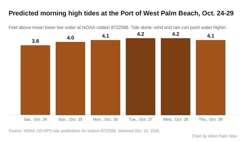
The predictions cover the tide alone. Wind and rain can push the water higher than the figures above. The city says the effects of a king tide can be seen from about 1.5 to 2 hours before the peak until 1.5 to 2 hours after it.
What it means for you
- Plan around the morning high tide Sunday through Thursday if you live, work or park near the Intracoastal Waterway or in a low-lying part of the city.
- Do not drive through standing water or around barricades. The weather service said some roads may close, and the city says standing water may be deeper than it looks.
- Move cars off low spots before the morning high tide. The city says floodwater can hide pollutants and broken glass, so keep children out of it.
- Stay out of the ocean if you are not a strong swimmer. Swim near a lifeguard. If a rip current catches you, relax and float, then swim along the shoreline, the weather service said.
- Report flooding in your neighborhood to the city at 561-822-2185. The city hotline is 561-822-2222.
The latest on the coastal flood warning is in our story on the warning. Our king tides guide has the full season’s dates through December. For closed roads, see road construction and closures, and for storm planning, our hurricane preparation guide.
Have your say